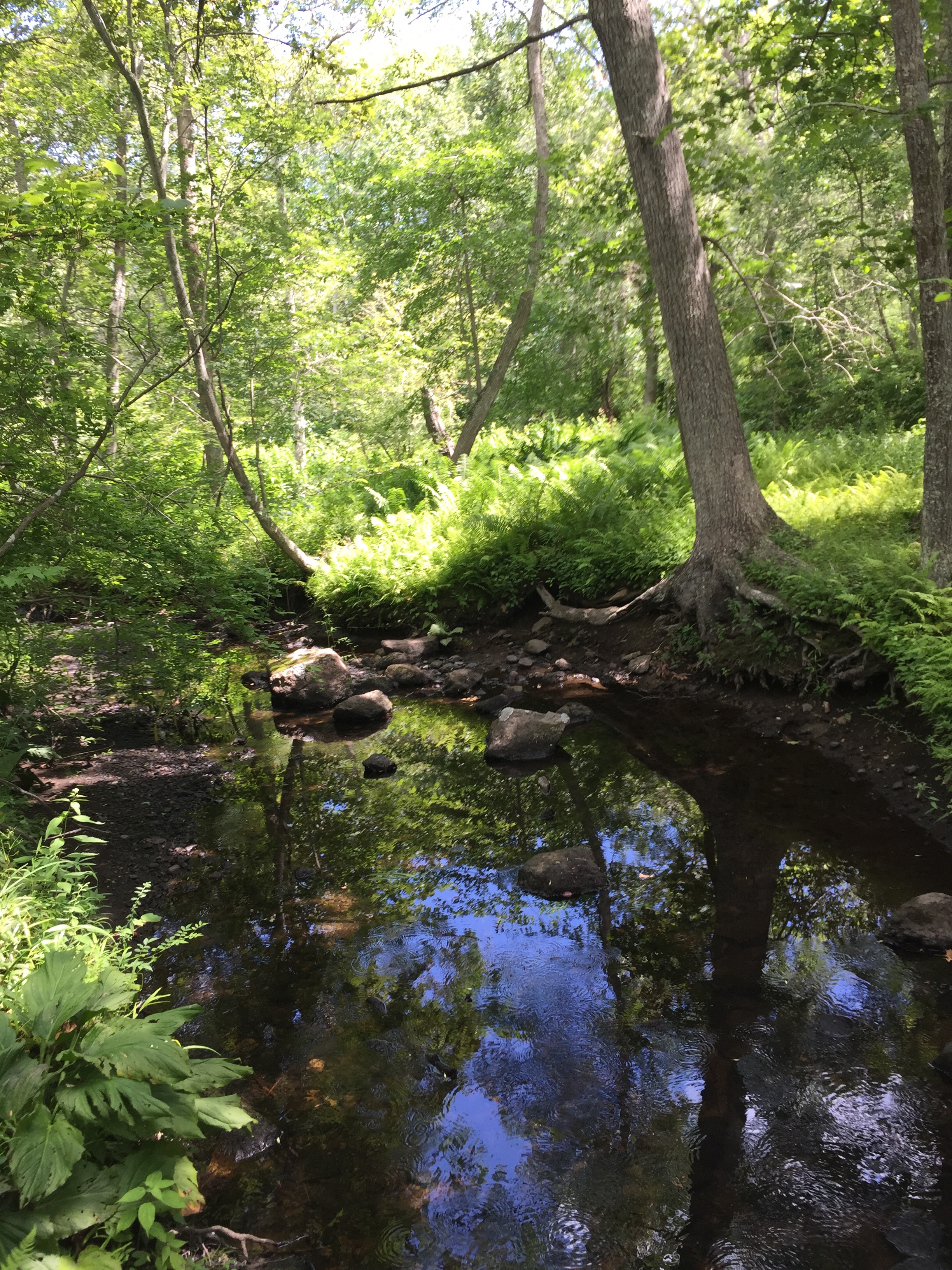
Sakonnet swamp
1 2021-03-10T14:58:08+00:00 Marisa Parham 0b3989f8b160e074aa2cff76ed0bc80e7e72fc17 6 1 Vital swamp in Awashonks' territory of Sakonnet (Wilbour Woods) plain 2021-03-10T14:58:08+00:00 Marisa Parham 0b3989f8b160e074aa2cff76ed0bc80e7e72fc17This page is referenced by:
-
1
2021-03-10T14:58:09+00:00
Another Queen’s Right: Awashonks
1
image_header
2021-03-10T14:58:09+00:00
Awashonks was the Saunkskwa of Sakonnet, to the south of Weetamoo’s territory of Pocasset, within the Wampanoag homeland. In August 1671, she sent a letter to Plymouth Governor Thomas Prence, discussing a council that had been held in Plymouth the month before.
Awashonks had only traveled to Patuxet (Plymouth) under threat of force. In early July, a newly formed “Council of War” had determined to march upon her territory and force her into submission, with 100 men led by Josiah Winslow, John Freeman and Matthew Fuller, with Constant Southworth as commissary. All of these men held stakes in Sakonnet land, which their fathers had granted to them. The land they desired had been surveyed and divided, but without Awashonks’ consent, all those lots being pledged, inherited, and sold remained meaningless.[1]Articles of Agreement
At Plymouth, Awashonks signed “articles of agreement,” including a formal submission of “her lands to the authority of the government.” They required that she and her men surrender their arms, as they likewise demanded of Metacom in a separate council. Ironically, the agreement also required that Awashonks would “bear some due proportion of the charge” if the Plymouth men felt compelled to take up arms against those Wampanoag people who might resist their settlement on her lands.[2]A Correspondence
However, the correspondence between Awashonks and Governor Prence following the “articles of agreement,” demonstrates crucial distinctions between the document and the oral exchange in council. The written agreement required Awashonks’ “submission” to the jurisdiction of Plymouth Colony. However, in her August 1671 letter to Prence, Awashonks spoke of “submitting to his majesty’s authority in your jurisdiction,” suggesting that she acknowledged the authority of the British King within Plymouth colony proper. While the Plymouth men claimed colonial dominion over the entire Wampanoag homeland, Awashonks did not acknowledge Plymouth’s “jurisdiction” in her territory. Her statement might be compared to Ousamequin’s statement, in the 1651 “Indian deed” that Plymouth could not claim Weetamoo’s territory of Pocasset through their agreement with him.[3]
In her letter, Awashonks expressed deference to Prence, promising to “stand” in “a peaceable submission” to his “commands” in honor of her “integrity and [her] real intentions of peace.” But this statement also emphasized her pursuit of diplomacy as a saunkskwa, not just her willingness to submit as a “subject” under his colonial authority, and a woman under his patriarchal authority. Awashonks also pledged the fidelity of some Sakonnet men, whom she described as “obedient to me, and I hope and am persuaded, faithful to you.” In acknowledging that he received her list, Prence described the men as those “that do freely submit to his majesty’s authority here, and likewise own your government and engagement with us.” His description suggests that Awashonks’ men formally recognized the King’s authority “here,” in Plymouth or New England, while “likewise” acknowledging Awashonks’ parallel “government” in her territory of Sakonnet, highlighting a mutual commitment to peaceful “engagement.” [4]
This agreement of peace and “faithfulness” was especially significant because of mounting rumors of Indian uprising in the colony. Awashonks seemed willing to intervene in her diplomatic role as a saunkskwa, to resolve and prevent conflicts with and among neighboring peoples. Further, while the Plymouth court required a symbolic laying down of arms, as a sign of peaceful intent and acknowledgment, in his correspondence, Prence expressed that he was fully willing to return the guns in the fall season as Awashonks’ men required them for hunting. Although Awashonks was compelled by threat of force to come into Plymouth, she engaged in negotiation over the relationship between Plymouth and Sakonnet, which was more complex than the “articles of agreement” revealed.[5]
Although Awashonks communicated her willingness to intervene with her kin, in his letter, Prence expressed disappointment over the scope of her influence. He noted some prominent names missing from the list of men she offered, including “your two sons, that may probably succeed you in your government, and your brother also, who is so nearly tied unto you by nature.” His complaint reflected the continuing frustration of colonial leaders with the lack of “command” that sachems and saunkskwas held over their kin, as well as a desire to replace Indigenous protocols with an English system of patriarchal control and succession. While acknowledging Awashonks’ “government,” Prence said he assumed her male heirs would “succeed” her. He asked, “do they think themselves so great as to disregard and affront his majesty’s interest and authority here, and the amity of the English? Certainly if they do,” Prence warned, he “wishe[d] they would yet show themselves wise, before it be too late.” [6]A Competing Claim
Thomas Prence died in 1673 and Josiah Winslow succeeded him as Governor of Plymouth Colony. Winslow pursued a different strategy to acquire access to and jurisdiction in Awashonks’ lands, by recognizing the authority of those male heirs. In November 1673, William Bradford recorded a deed, dated July 1673, in which Awashonks and her son, Peter, granted “unto the proprietors of the lands of Seconet” a large “tract” of land “upon” Sakonnet neck. Although Awashonks herself did not appear to acknowledge her “mark,” “Peter the son of Awashunks appeared” in November, according to Bradford, “and freely assented to this act and deed,” confirming his “mark” of consent. This served as validation of a deed for the same lands that the proprietors simultaneously secured from Awashonks’ other son, Mammanuah.[7]
In Plymouth’s records regarding the Saconet proprietors, Mammanuah asserted that he held the primary rights of the sachemship, through patrilineal inheritance, claiming that the power held by his mother and his mother’s brother was illegitimate -- of a “more remote stock” than his own. Other Sakonnet men, his kin, had acknowledged in an “agreement” with the “Seconet” proprietors that he “should be the true proprietor and diposer of all our Lands.” The Court advised that “proportions of land” should be “settled on” Awashonks and her brother Tatacomanuh, with the remainder of Sakonnet under the control of Mammanuah and themselves.[8]
In the spring of 1674, at planting time, Mammanuah and the “Saconnet proprietors” attempted to implement the deed on the ground. When Awashonks responded by forcibly re-asserting jurisdiction over her lands and her son, the court responded by imposing its own authority. They required that she submit to “his majesties’” jurisdiction, based on the 1671 agreement, and allow them to arbitrate the conflict between her and her son. Not surprisingly, in July 1674, the Plymouth Court resolved that Mammanuah, the plaintiff, had a just right to the sachemship and was thereby authorized to sell land to them. William Bradford, Josiah Winslow, James Cudworth, Constant Southworth and their fellow magistrates formally confirmed Mammanuah as the “chief proprietor of the lands of Saconett, and places adjacent,” circumventing this “Queen’s Right” by empowering her son. Using their court to impose a system of colonial and patriarchal authority over the Sakonnet saunskwa’s rights and responsibilities, the Plymouth men successfully circumvented her authority, severely limiting the land on which even she was allowed to subsist.[9]The Saunkskwa's seat
The lands at the south side of Sakonnet point, the area encompassing Awashonks’ primary seat, were excepted from the 1673 deeds. The southern bounds of the deed were “the Indian path” at Totherswamp, with the northern bounds being at “Pachet brook,” the southern outlet of Nonquit pond, in an area where Pocasset and Sakonnet lands met. [map or link to Dartmouth Deeded Lands Page] However, just before the outbreak of war, in April 1675, Mammanuah signed a deed relinquishing this territory as well, including all the land from Pocasset Neck “south to Sakonnet Point” and the “Main Sea,” extending “east to Dartmouth bounds” although the deed was not recorded, with Mammanuah’s confirmation, until March 1677.[10]
This new deed extended to Pocasset neck, moving toward Weetamoo’s territory, as well. And during the summer of 1674, the Plymouth men also sought Mammanuah’s consent to their growing settlement at Dartmouth, adjacent to Sakonnet, including an expansion that would bring them into Weetamoo’s lands at Pocasset.[1] Nathaniel Bradstreet Shurtleff, Records of the Colony of New Plymouth, in New England (Boston: William White, 1857) 3:216, 5: 73-5, 64. Ebenezer Peirce, Indian History, Biography and Genealogy (North Abington, MA: Zerviah Gould Mitchell, 1878), 247-54. Thomas Hinckley and Nathan Bacon to Governor Prince, July 7, 1671, Winslow Family Papers II, Massachusetts Historical Society. Douglas Edward Leach, Flintlock and Tomahawk: New England in King Philip’s War (Hyannis, MA: Parnassus Imprints, 1996), 27.[2] Collections of the Massachusetts Historical Society (Boston: The Society, 1792-1888), ser. 1, vol. 5, 193-4.[3] Collections of the Massachusetts Historical Society, ser. 1, vol. 5, 193-7.[4] Collections of the Massachusetts Historical Society, ser. 1, vol. 5, 195-7. Peirce, Indian History, 247-254.[5] Collections of the Massachusetts Historical Society, ser. 1, vol. 5, 195-7. Peirce, Indian History, 247-254.[6] Collections of the Massachusetts Historical Society, ser. 1, vol. 5, 197.[7] “Purchase of Lands in Little Compton RI 1672/3 from the Sakonnet Indians,” Society for Colonial Wars, no. 52 (RIHS). Jeremy Dupertuis Bangs, Indian Deeds: Land Transactions in Plymouth Colony, 1620-1691 (Boston: New England Historic Genealogical Society, 2008), 465.[8] Bangs, Indian Deeds, 452, 460-1.[9] Nathaniel Bradstreet Shurtleff, Records of the Colony of New Plymouth, in New England (Boston: William White, 1857) 7:191. Bangs, Indian Deeds, 460-1, 452. Drake, Book of the Indians (Boston: Josiah Drake, 1833) 3:67, 72.[10] “Purchase of Lands in Little Compton RI 1672/3 from the Sakonnet Indians,” Society for Colonial Wars, no. 52 (RIHS). Dexter ed., History of King Philip’s War, xviii, 2-5. Bangs, Indian Deeds, 465-7. Bangs, Indian Deeds, 478. -
1
2021-03-10T14:59:07+00:00
Pocasset and Pokanoket Placenames, Wampanoag Country
1
image_header
2021-03-10T14:59:07+00:00
For Weetamoo and her neighboring sachems, their lands were dynamic, storied ecosystems, crucial for subsistence and ceremony, used in accordance with seasonal cycles. Myles Standish, the military leader of the Plymouth settlers, described Ousamequin’s central home of Sowams, in the Pokanoket homeland, as “the garden” of Wampanoag territory, a fertile meeting place of tributaries, freshwater springs and tidewater estuaries, ideal for fishing and gathering, as well as agriculture. But his description erased the labor of the Native women, like Weetamoo, who cultivated the many “gardens” in Wampanoag territory. Here, extended families of women planted intercropped mounds on peninsulas, fertile bowls, naturally bounded by water, that provided plenty of space to plant and minimized conflict and competition over resources.These planting peninsulas of Pokanoket included Annawomscutt, just east of the river Seekonk; Sowams, Chachacust and Montaup to the north and south; Kickemuit, at the narrows, to the west, where a spring fed the streams; and across the narrows, Toowooset. The waterways surrounding these peninsulas provided vital shellfish harvesting and fishing, especially as the alewife and herring runs came through in the spring. Wampanoag families inhabited all of these places, with usage rights determined through ancestral bonds and council negotiation; stories, ceremony and longstanding adapted practice enacted fair distribution and sustainability of resources. The peninsulas and families were connected by a network of trails, canoe routes and kinship. Through councils and exchange, Wampanoag leaders attempted to draw their English neighbors into this network of relationships.
However, English men viewed the Wampanoag territory with an eye to division, seeking deeds and conducting surveys through which parcels of land could be allotted for sale and patrilineal inheritance. For example, in seeking title from Ousamequin and Wamsutta in 1652 to “Sowams and parts adjacent,” Plymouth settlers sought to cut the planting peninsulas into “necks” which could be used for “mowable land” and pasture, and eventually, divided into lots for plowing and planting furrows. With the deed, they laid claim to salt and freshwater meadow on either side of the “great river” of Sowams, drawing an imaginary line from Moskituash brook, the estuary stream that flows into Popanomsat (now Bullock’s Cove) and the Seekonk (or Providence) River, to the planting ground of Kickemuit.
Beyond Kickemuit and Toowooset, to the east, was Weetamoo’s homeland of Pocasset, including Mattapoisett, where Weetamoo spent much of her childhood. Paths moved east to Shawamet, across the Kteticut river (a crossing often made by canoe “ferry”) to the planting grounds at Assonet, which hosted spring herring runs at the narrows near Assonet Bay. Trails led east and south through the dense woods and marshes of the Pocasset hunting grounds to Weetamoo’s town at the falls of Quequechand. The river’s source was the ponds of Watuppa, with streams and trails leading south to the Acoaxet river and the adjoining coastal rivers of Sakonnet, Apponaganset and Achushnet, interconnected Wampanoag communities with prime shellfish gathering and fishing places.