Moose-IMG-PP6.jpg
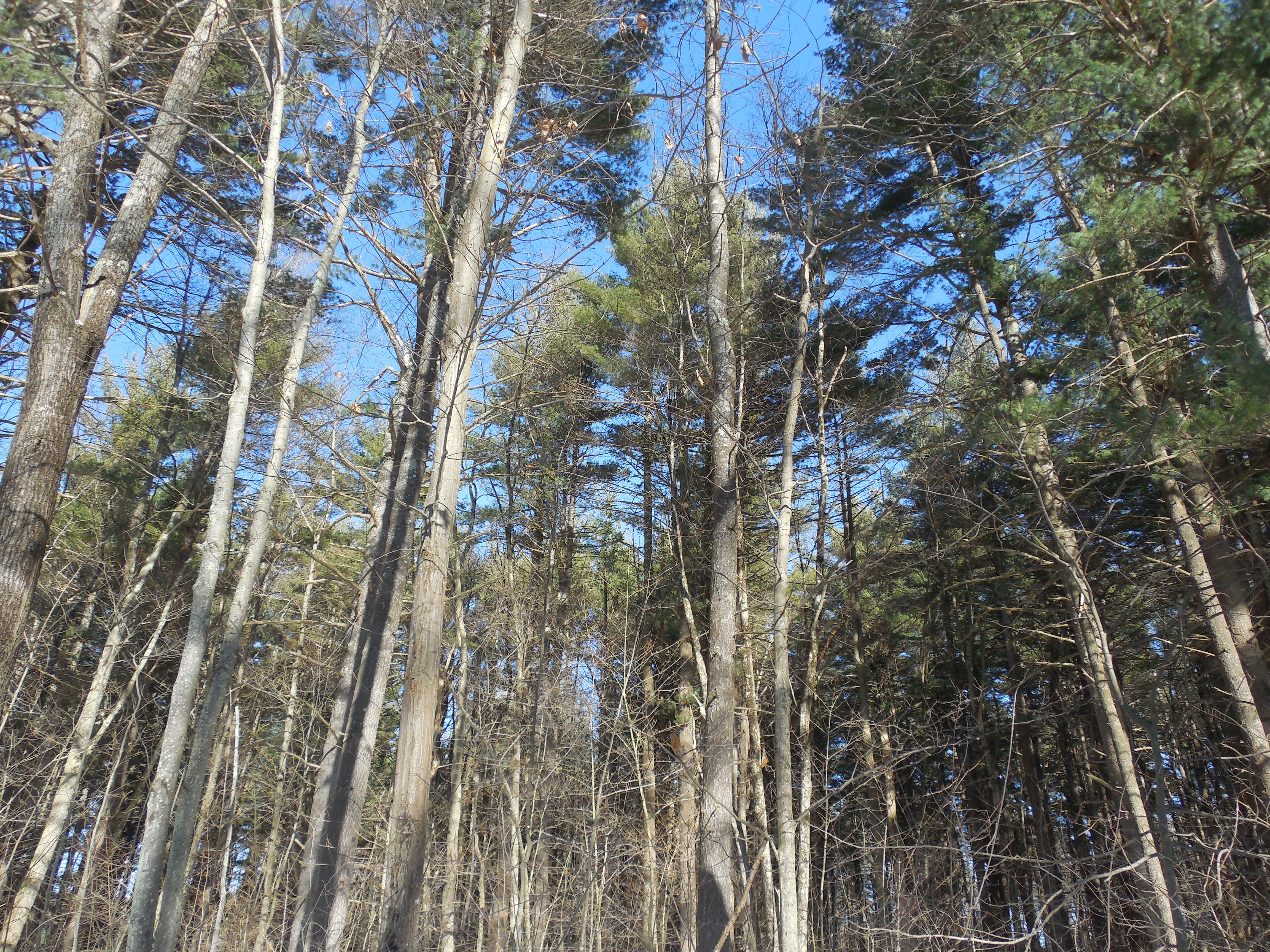
1 2021-03-10T14:58:00+00:00 Marisa Parham 0b3989f8b160e074aa2cff76ed0bc80e7e72fc17 6 1 Moose grazing by the headwaters of the Connecticut River, Summer plain 2021-03-10T14:58:00+00:00 Marisa Parham 0b3989f8b160e074aa2cff76ed0bc80e7e72fc17This page is referenced by:
-
1
2021-03-10T14:57:53+00:00
Raids on Cascoak, Saco & Newichiwannock, Fall 1675
1
image_header
2021-03-10T14:57:53+00:00
When Wabanaki protectors began striking English settlements in their territory, in Fall 1675, they targeted colonial structures, including mills and houses-turned-garrisons, which had been built in the locations of traditional planting fields and fishing falls. Close kinship ties and extensive trade routes connected Wabanaki families throughout this region. These raids represented not only resistance to colonial logging operations and mills, but also the reclamation of Wabanaki planting towns, from Piscataqua to Pejebscot.
This map of “Ancient Falmouth” shows "Ammoncongan falls," the traditional planting and fishing place on the Presumpscot River, to which Warrabitta and Skitterygusset's people belonged, with the “Kings Highway” going to the falls and George Munjoy's deed encompassing Ammongcongan and Sacarappa. These were vital locations for harnessing the river’s energy for colonial mills, especially to fuel logging operations on the Presumpscot River, but they were simultaneously vital Wabanaki fisheries and subsistence grounds. These conflicts over the falls would continue for decades, culminating in the fifth Abenaki-Anglo war (King George's War) of 1744-9. Ammoncongan was also the site of one of the first raids on the northern front, on September 12, 1675 at the recently built home of John Wakely, three-quarters of a mile below the mill at Presumpscot falls, in the territory of Caskoak.
Note that the "Kings Highway” was a rough cart road from from Kittery to Falmouth (Portland), the only colonial road that connected the northern settlements to Massachusetts Bay. Contrast this "road" with the extensive network of Wabanaki trails and canoe routes. (Ammoncongan, on the Presumpscot, should not be confused with the similarly named fishing falls on the upper Androscoggin)
In mid-September, protectors also struck at Owascoag, where Warrabitta and her mother had planted, killing Lieutenant John Alger in an ambush, and also his brother Arthur, then destroying several houses, including those belonging to Alger descendants. At about the same time, a large group of protectors traveled over the Saco River to strike the mills on the lower Saco Falls, burning a saw mill and grist mill belonging to Major Phillips.[1] The lower falls was a key fishing location, but these strikes may have also been aiming to prevent settlers from moving upriver, to other vital falls.
Mills were not only a sign of colonial imposition, but an obstruction which interfered with the passage of the anadromous fish, like salmon and shad, that swam upriver to their spawning grounds. In addition to supporting the construction of English settlements, the mills were closely tied to colonial industries, including the Atlantic fishery and lumber export.
As historian Mary Beth Norton has observed, “In 1675, about 440 fishing boats operated off the coast between Boston and the Kennebec…and at least fifty sawmills each produced up to a thousand feet a day of white pine boards.” The immense white pines, which grew to three hundred feet tall, were in high demand, both for masts reserved for the English king’s ships, and for construction. To the south, New Hampshire settlers, including the trader Richard Waldron, had established a colony based on the new lumber economy. Among the first saw and grist mills were those built at major fishing falls at Newichiwanock, Cocheco, and Caskoak, and the number of mills, built on Wabanaki rivers, increased tremendously in the decades that followed. The settlements of Cocheco (Dover), Oyster River (Durham) and Newichiwannock (Salmon Falls/South Berwick) were “the sites of large numbers of sawmills.” “All” of these “towns,” Massachusetts minister William Hubbard observed, were “seated upon” rivers “whose streams are principally improved for driving of saw mills, those late inventions so useful for the destruction of wood and timber, especially fir trees which do so abound on those coasts, that there is scarce a river or creek in those parts that hath not some of those engines erected upon them.” Yet at the upriver Piscataqua settlements such as “Salmon Falls, Newichiwannock, Cocheco and Oyster River,” deforestation was occurring at too rapid a pace for production. As Hubbard observed, their “rift timber is near all consumed,” with the trade turning to “deal boards cut by those saw mills.” [1]
In September and October, Wabanaki protectors struck Newichiwannock, where settlers had taken over the fertile planting fields and vital fishing falls. Hopehood, a leader whose kinship ties connected multiple Wabanaki homelands, led a party from Ossipee, to strike a garrison house belonging to Richard Tozier, which was built on fertile land along the Newichiwannock River, above the falls at Quamphegan. At the time, Tozier was with Captain John Wincoll, attempting to engage "enemy Indians" at Winter Harbor (Biddeford Pool), at the mouth of the Saco River. The next day, Hopehood and his company targeted Wincoll's large settlement, above Tozier's garrison. Wincoll had constructed one of the first mills at Newichiwannock and was deeply invested in the production of the sawmills, holding "extensive grants of land and lumber above the Falls.” According to William Williamson, they “set fire to the dwellinghouse and buildings of Capt. Wincoln, which which were standing near the upper mills, and reduced them and their contents to ashes," including "one of his barns containing more than 100 bushels of corn.” Two weeks later, Wabanaki protectors struck Tozier's garrison again and ambushed a group of colonial militia, led by lieutenant Roger Plaisted. [3]
It was the "saw-mills on the Great Works River," at the confluence with the Newichiwannock or Salmon Falls River, that "attracted settlers to" Quamphegan, and they soon took up "all the river lots" granted by local colonial leaders. An earlier deed marked by the sachem Rowls had allowed the trader Humphrey Chadbourne land and water power rights at Quamphegan, while reserving subsistence rights for Rowls and his people. Chadbourne's mill right was then sold and transferred through several hands, while the extensive mills were built into "the Great Works" and then fell into disrepair, until William Hutchinson and his brother "got possession of the property and rented it to various tenants, the chief of whom was Roger Plaisted.” Thus, Wabanaki people would have associated Plaisted with the mill that he ran, and where he lived, not just with the garrison house he converted for war. They may have targeted Plaisted for his dual roll in operating the sawmill at the fishing falls at Quamphegan and leading a military company to assert and defend those rights against Wabanaki protectors. At Cocheco, the trader and military commander Richard Waldron feared his garrison house, barns and mills were next. The raids not only impacted colonial settlements, but the transatlantic colonial economy.[4]
The first act of war on the Northern Front, as colonial narrators wrote the story, was the raid on Thomas Purchase’s trading post, at Pejebscot, on the lower Androscoggin river, on September 5, 1675. Purchase was among those traders known for their false dealings, including the use of liquor, to swindle Native people of their goods and their land. This was especially troublesome in Wabanaki territory, where trade networks were designed to build and maintain relationships of reciprocity and exchange, a powerful form of diplomacy. When these networks broke down, or were disrupted, as they were here, war was one form of restoring the balance.
The reputation of traders had only suffered more as the price of moose skins plummeted in the 1670s. Moose, like beaver, had previously been coveted in England, where moose hide, thick with fur, became quite “fashionable.” However, with the decline in fur and fashion, hunters received less goods for their hides, which they perceived as a serious infringement of reciprocal relations. Ordinarily plentiful in the north woods, moose also provided an essential winter food source for families, but, like beaver, the moose population had declined with the increasing demands of the fur trade. This was one of the reasons why the confiscation of weapons, alongside an embargo on the sale of guns, powder and shot, was so devastating to families on the Kennebec, making winter hunting and survival all the more difficult. Combined with logging and mills on the rivers, subsistence was compromised on multiple fronts.[5][1] James Phinney Baxter, ed., Documentary History of the State of Maine (Baxter Manuscripts) (Portland, ME: Maine Historical Society, 1900), 6:93-6.
[2] Mary Beth Norton, In the Devil’s Snare: The Salem Witchcraft Crisis of 1692 (New York: Vintage Books, 2003) 85. Emerson Baker, “Finding the Almouchiquois: Native American Families, Territories, and Land Sales in Southern Maine,” Ethnohistory 51, no. 1 (2004): 73–100. Emerson Baker and John Reid, “Amerindian Power in the Early Modern Northeast: A Reappraisal,” William and Mary Quarterly 61, no. 1 (2004). Emerson Baker, “Trouble to the Eastward: The Failure of Anglo-Indian Relations in Early Maine” (PhD diss., College of William and Mary, 1986). Kenneth Morrison, The Embattled Northeast (Berkeley: University of California Press, 1984). Gideon Ridlon, Saco Valley Settlements and Families: Historical, Biographical, Genealogical, Traditional, and Legendary (1895) (Somersworth, NH: New England History Press, 1984), 191. also James Sullivan, History of District of Maine (Boston: Thomas and Andrews, 1795), 246. William Hubbard, A History of the Indian Wars in New England, ed. Samuel Gardner Drake (Roxbury, MA: W. E. Woodward, 1865), 250. William Williamson, History of the State of Maine (Hallowell, ME: Glazier, Masters and Co., 1832). William Willis, History of Portland from 1632 to 1864 (Portland, ME: Bailey and Noyes, 1865).
[3] Williamson, History of the State of Maine, 524-5. William Hubbard, A History of the Indian Wars in New England, ed. Samuel Gardner Drake (Roxbury, MA: W. E. Woodward, 1865), 113-5, 118-124. Everett Schermerhorn Stackpole, Old Kittery and Her Families (Kittery, ME: Press of Lewiston journal Company, 1903), 106-112, 128-134.
[4] Williamson, History of the State of Maine, 524-5. William Hubbard, History of the Indian Wars, ed. Samuel Gardner Drake, 117-124. Stackpole, Old Kittery, 106-112, 128-134. "Forgotten Frontiers" Exhibit, Old Berwick Historical Society, South Berwick, Maine.
[5] Baker, “Trouble to the Eastward," 142-6. Morrison, Embattled Northeast, 89.
-
1
2021-03-10T14:58:42+00:00
Wannalancet and the Kwinitekw Headwaters
1
image_header
2021-03-10T14:58:42+00:00
The Penacook sachem Passaconaway was renowned for his power and diplomacy in the wake of the first waves of colonization. He joined with other leaders in the region, including the Saunkskwa of Massachusett and her husband Nanapashemet, to gather families together, after devastating epidemics ravaged Indigenous communities, especially along the Massachusett coast, as both colonial captivities and intertribal conflict fostered further ruptures. Passaconaway’s children intermarried with other leadership families, repairing the binds within the network of relations and creating a safety net for survivors. The Penacook network or “sphere of influence” centered on Molôdomak, the deep river, but extended through waterways to the inland and coast. These were among the leaders who signed an important agreement with Massachusetts colony in 1644, creating binding relationships with the newcomers. This agreement is among the most significant documents that the Massachusetts State Archives holds today. [1]
During King Philip’s War, many Native people sought protection, as they had done earlier, within these networks of waterways and kinship, and this strong web enabled travel into northern sanctuaries. Passaconaway’s son, Wannalancet, pursued a strategy of neutrality early on, leading families from Penacook north to avoid the burgeoning conflict to the south, one of many paths to peace. As the Massachusetts missionary and magistrate Daniel Gookin observed, the Penacook sagamore took shelter with his kin at
This was a densely forested region above the White Mountains, well known to Wabanaki people, but well beyond the knowledge and reach of English magistrates or military leaders.“the head of Connecticut River all winter where was a place of good hunting for moose, deer, bear, and other such wild beasts; and came not near either to the English, or his own countrymen, our enemies.”[2]
Wanalancet and the families who went with him may also have traveled, during the fall and winter of 1675 the spring of 1676, to other key locations within these vast kin networks, including the French missions at Sillery, Sorel and Odanak (St. Francis), in Quebec, or to other Wabanaki towns and territories in the interior, on vital waterways like the Kennebec, Androscoggin and Saco Rivers, Lake Memphremagog and Lac Megantic. Wanalancet’s wife reportedly was tied to the mission villages, while his brother Nanamocumuck had found refuge, decades earlier, in the Wabanaki communities on the Androscoggin River. Penacook people were mobile and often traveled in smaller groups of extended families, particularly in the fall and winter hunting season. Thus, it would not be surprising to find them among several communities or multiple locations during the war. Wanalancet was also among those who cultivated a peace treaty in the summer of 1676, traveling to the Wabanaki coast with other leaders, including Samuel Numphow and the Saco River leader known as Squando, to participate in councils that led to the Cocheco Treaty of July 1676. [3]
The spruce and fir forests of the Connecticut River headwaters remain a vital sanctuary for many Indigenous animals, including moose, deer and bear, as well as vital medicinal plants. It is a place to which many Wabanaki families, as well as other Native people, regularly return to hunt, fish, camp and gather, or simply to remember, along old paths. Wabanaki basketmakers used those same trails to travel back and forth between northern New England and Quebec in the nineteenth and twentieth centuries. The “North Country” also appears in contemporary literature. Mohegan author Melissa Tantaquidgeon Zobel’s young adult novel Wabanaki Blues features an Abenaki-Mohegan protagonist who returns to her mother’s North Country roots. Abenaki author Cheryl Savageau has published several poems that reflect the tradition of return to the North Country, as sanctuary, for both the living and the dead. [Link to Northeastern Naturalist article] Savageau lovingly describes her own father’s relationship to this northern land in her poem, “To Human Skin” from Dirt Road Home:Over the last meal
we’ll ever eat together
he tells me, I’m going up north,
up to the old home country,
Abenaki country. He smiles
in anticipation, his feet
already feeling the forest floor,
while my stomach tightens
with the knowledge that he
is going home. I push
the feeling away. But when spirit
talks to spirit, there is no denying.
Through the long days of mourning,
I see my father’s spirit
walk into the bright autumn woods.
Red, gold, and evergreen,
they welcome him back,
his relatives, green of heart,
and rooted, like him,
in the soil of this land
called Ndakinna.[1] David Stewart-Smith, “The Penacook Indians and the New England Frontier, 1604–1733,” (PhD diss., Union Institute, 1998), 1-33, 52-91. See also Neal Salisbury, Manitou and Providence: Indians, Europeans, and the Making of New England, 1500–1643 (New York: Oxford University Press, 1982), 42, 48, 54-72. John Pendergast, The Bend in the River (Tyngsborough, MA: Merrimac River Press, 1992). Solon B. Colby, Colby’s Indian History: Antiquities of the New Hampshire Indians and Their Neighbors (Conway, NH: Walkers Pond Press, 1975).[2] Daniel Gookin, “An Historical Account of the Doings and Sufferings of the Christian Indians in New England” in Transactions and Collections of the American Antiquarian Society 2 (Cambridge: American Antiquarian Society, 1836), 462.[3]Colin Calloway, The Western Abenakis of Vermont (Norman: University of Oklahoma Press, 1990), 274-5. Gordon Day, Identity of the Saint Francis Indians (Ottawa: National Museums of Canada, 1981), 16-18. Evan Haefeli and Kevin Sweeney, “Watanummon’s World: Personal and Tribal Identity in the Algonquian Diaspora c. 1660-1712” in Papers of the Twenty-fifth Algonquian Conference, ed., William Cowan (Ottawa: Carlton University, 1994), 212-5. Dennis Connole, Indians of the Nipmuck Country in Southern New England, 1630–1750 (Jefferson, NC: McFarland and Company, 2001), 53-4. George Bodge, Soldiers in King Philip’s War (Boston: George Madison Bodge, 1906), 304.