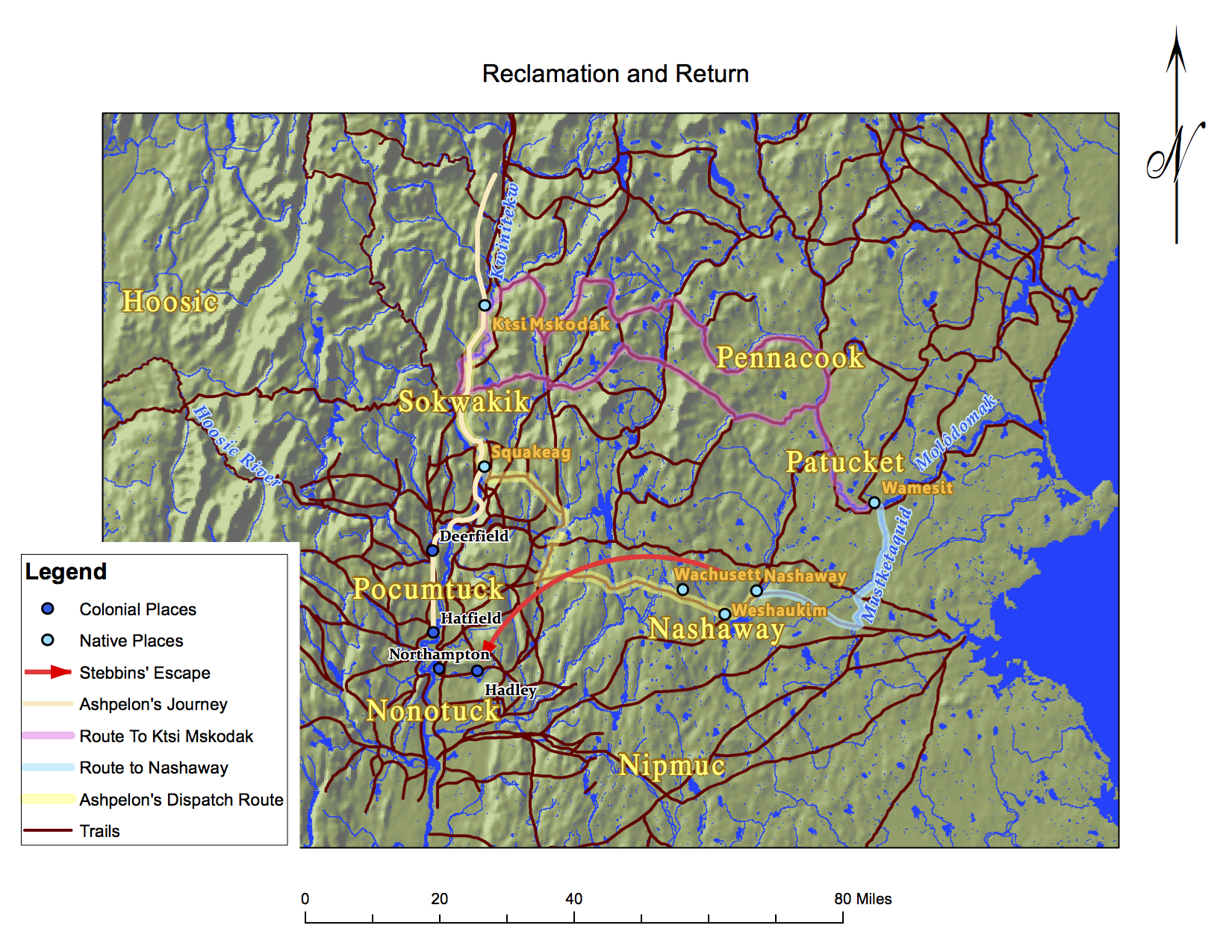
ashpelon-journey-crv-stebbins-routes-MAP-UEW9.jpg
1 2017-05-29T18:40:42+00:00 Marisa Parham 0b3989f8b160e074aa2cff76ed0bc80e7e72fc17 6 4 Map of Ashpelon's Journey and Stebbins' routes created by Heru Craig plain 2017-06-13T16:24:00+00:00 Lisa Brooks fec693e828c406419bf2b9fc046e7ea8bc7558cbThis page is referenced by:
-
1
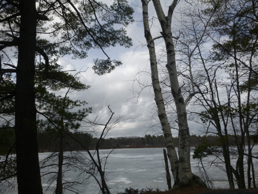
../media/images/bank-view2-from-river-IMG-CL.jpg
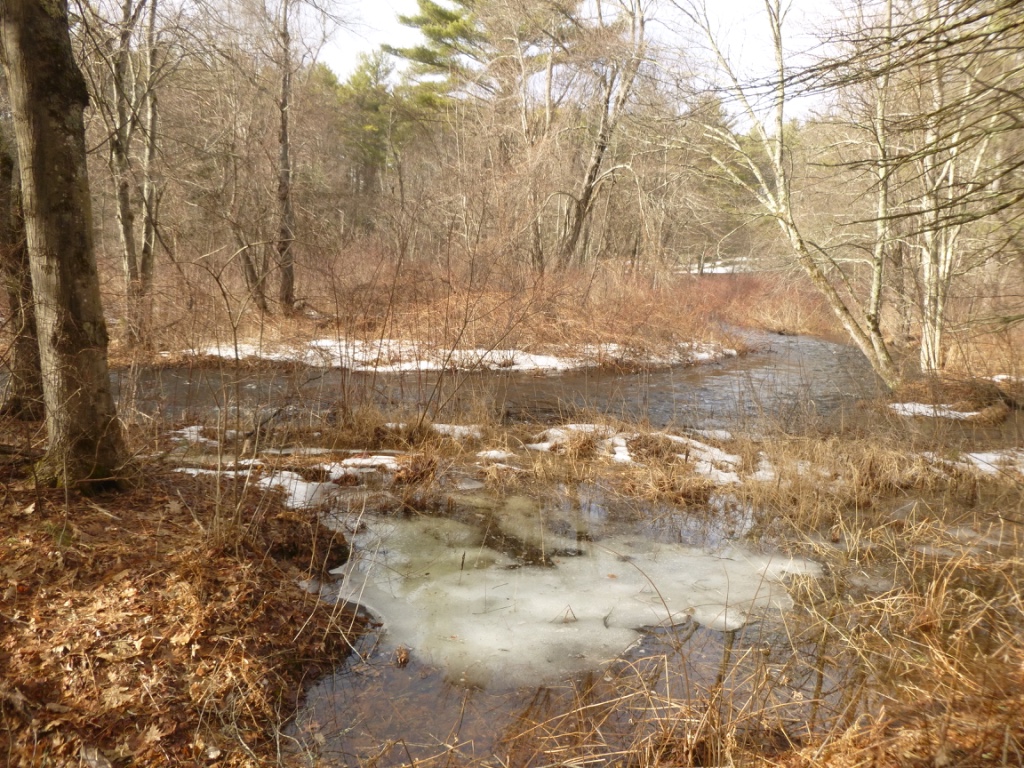
../media/images/wachusett-view-water-IMG-CL.jpg
2017-05-29T18:40:41+00:00
The Journey to Nashaway/Wachusett
17
Contributed by Heru Craig
image_header
2019-06-03T14:51:20+00:00
Stebbins' Split
When Ashpelon's party reached Ktsi Mskodak, or Great Meadow, Ashpelon sent a group of about half of his people down “to Nashaway, to call of some Indians that have bin there all this tyme of ye war & took this Benoni Stebbins along with them thither.”[1] Benoni Stebbins, who was captured along with Stockwell in Ashpelon's raid on Deerfield, served as a principal source in reconstructing these events. The goal of the party he traveled with was to go into Nashaway territory and meet with the people living in the area. The pale yellow line on the map traces the route that Stebbins reports the party having taken as far south as Squakeag and then follows their likely course southeast into the Nashaway region.
Stebbins’ accounts, recounted second-hand by the postmaster of Northampton and John Pynchon, [2] play an important role in piecing together the course of the second split. Soon after arriving in Hadley, Stebbins dictated a brief version of his account to the Postmaster in nearby Northampton. In the two documents he referred to their destination as either “Wachuset hills” or “Nashaway ponds.” On both maps, one can see that Nashaway is the name of a larger Native territory. Looking at the smaller map, one can see that it is also the name of a specific location. Nashaway ponds would refer more specifically to Weshaukim, another location indicated on the map. “Wotchuset hills” refers to the area at and around Mount Wachusett. All of these specific locations are within the larger Native territory Nashaway.
Stebbins escaped from Nashaway around October 2 while he was with the group that Ashpelon sent to rendezvous. The group generally retraced their steps until they reached Squakeag, as Stebbins reported. They then had many options as to how they could proceed to their destination. On the above map, we have an example of a path they may have taken. He was sent with them as a captive, and “being sent with 2 squas and a mare to fetch some hucleberies a litle way from the company...he got upon the mare and rid till he tired the mare...& so escaped to Hadly, being 2 days & ½ with out victuals.”[3] The red arrow on the map indicates the general course of his escape and return to colonized space.A Councilor
While with the party sent by Ashpelon to rendezvous in the Nashaway territory, Benoni Stebbins spoke of
If Wanalancet did travel to Nashaway from Wamesit, he may have been this “counsellor.” Given Wanalancet's influence, he would have stood out, perhaps even among a group of other sachems. This part of the account lines up with other details about Wanalancet. In 1675, as the violence at the start of King Philip’s War, or the first Anglo-Abenaki war, caused fear and anti-Native sentiment to grow, Wanalancet maintained his stance of neutrality and went so far as to remove with his people to the woods around Penacook. Massachusetts Bay colony officials sent messengers to try and convince him to return to Wamesit (Patucket) “but he could not be prevailed with to return, but travelled up into the woods further afterward, and kept about the head of Connecticut river all winter, where was a place of good hunting.” [5] Protected from colonial incursion and at a place where one could hunt to subsist, the Kwinitekw headwaters (note location on map to the right) were a haven to Wanalancet and his people. With relations between the Native peoples of the valley and the Massachusetts Bay colony still tense, is it difficult to imagine that Wanalancet would suggest a return to the headwaters as a course of action for their group?one of ye Indians that they had from about Nashaway Ponds, semes to be a counsellor, & with him they consulted much & spake of sending to ye English, but a last resolved for Canada yet talked of making a forte a greate way up the River & abiding there this winter.[4]
Each of the purple lines on the map at the top represents a well-established trail that would have been available to a Native party heading to Ktsi Mskodak from Wamesit. Together, they form a network that would allow for confident travel across the vast distances shown on the maps. Naturally, they could very well have taken the same route back that Ashpelon's rendezvous party took to get to Nashaway; however, it seems likely that they would have taken a route that didn't bring them closer to colonial occupied space.By the Numbers
Stockwell went on to report in his narrative that “when those Indians came from Wachusett, there came with them squaws and children, about four score.”[6] This large number begins to make sense when we consider the number of people reported to be living at Wamesit alone, which would be 42, or just over two score. By Gookin's accounting, “those that went away [with Wanalancet] were about fifty, whereof there were not above eight men, the rest women and children.”[7] This means that the people at Wamesit alone numbered around 50.
Upon his return, Stebbins reported that he had seen “3 Indian men & about halfe a score of [women]” at Nashaway. He also spoke of picking up Native people who had been living in the Nashaway region during the war. He specifically mentioned that there were “2 smal compeny of Indians that had lived there al this war time.”[8] But, Stebbins did leave before the group returned to Ktsi Mskodak. Is it possible that he simply hadn’t been there when the entire group was assembled to return? Were the 13 people Stebbins reported seeing part of just one of the companies? If so, that would bring the total to 52 people, only accounting for women and children--63 if one accounts for everyone at Wamesit and the 13 present at the time. Is it then difficult to imagine this group as the one Stockwell reports as coming in with about 80 women and children?Survivors
These were survivors of the war. The Penacooks are a good example of the means Native people employed to survive. While they may not always have been of one mind on how to generally interact with the English, they did what was necessary to survive. It is likely that some of the people who reportedly stayed in the region “al this war time” had gone back and forth between their homeland and places like Penacook and the Connecticut River Valley--and perhaps as far as Schaghticoke and French Canada. On just this one journey, over 100 people moved northwards to continue living. The people of the area that would become New England didn’t vanish, nor was “the enemy” completely destroyed. Displaced by violence and discriminated against by their former neighbors, many moved northward. After this period, many continued to travel regularly between Canada, Wabanaki territory and southern New England.[1] “Letter from Major John Pynchon,” 53.[2] “Narrative of Benoni Stebbins,” 57; “Letter from Major John Pynchon,” 51-6.[3] “Narrative of Benoni Stebbins,” 57.[4] “Letter from Major John Pynchon,” 54.[5] Gookin, “Christian Indians,” 462-3.[6] Evan Haefeli and Kevin Sweeney, Captors and Captives: The 1704 French and Indian Raid on Deerfield (Amherst: University of Massachusetts, 2003), 42.[7] Gookin, “Christian Indians,” 521.[8] “Letter from Major John Pynchon,” 54, 57. -
1
2017-05-29T18:40:42+00:00
Benoni Stebbins' Account: "a forte a greate way up the River"
6
Contributed by Maggie King
plain
2019-06-03T14:41:36+00:00
Sixteen days after Ashpelon’s raid, in a letter dated October 5, 1677, Major John Pynchon of Springfield requested assistance from Captain Sylvester Salisbury at Albany to solicit the aid of Mohawk sachems to intercept the party and return its English captives to safety.[1] His detailed account of the party’s whereabouts came from the account of captive Benoni Stebbins, who had been captured at Deerfield. Ashpelon’s party carried Stebbins with them upriver to Ktsi Mskodak, a fertile Sokoki intervale on the upper Kwinitekw, a refuge nearly unknown to English colonists. Stebbins was then taken with part of Ashpelon’s party, as the group split and headed east from Ktsi Mskodak to retrieve relations near Wachusett and Wamesit. Stebbins stole a horse somewhere near Nashaway, escaped and ran toward Hadley. Back in the colonial settlements, Stebbins relayed his story to the Northampton postmaster, Samuel Ells, who passed it on to Pynchon, a prominent local trader and military leader.[2]
As missionary Daniel Gookin later reported, at Wamesit, Wannalancet, a Penacook sachem, and “about fifty” of his people, being mostly “women and children,” were induced “either by force or persuasion” by “Indians that come from the French” to head north to Canada. The Indians that came for Wannalancet were “his kindred and relations” who told him that “the war” with the English “was not yet at an end,” that he would find “more safety among the French.” [3] Safer as it was for Indians in New France than in Puritan New England, inland spaces sometimes offered a better alternative to established, domesticated settlements—personal and political autonomy, game-filled hunting grounds, unmolested forests, and, above all, evasion from colonial oversight. In his letter Pynchon relayed to Salisbury that a “counsellor,” who came from “about Nashaway Ponds” (possibly referring to Wannalancet, en route from Wamesit, or one of the Nashaway/“Wachusett sachems”), “talkt of making a forte a greate way up the River & abiding there this winter.” [4] What would make the upper Kwinitekw an appealing place to seek refuge?
The counsellor could have been referring to either Ktsi Mskodak, where Ashpelon’s main party was encamped; Koasek, another Abenaki intervale further upriver, which had provided refuge to peoples during the summer of 1676; or the Kwinitekw headwaters, where Wannalancet and the Penacooks had spent the winter of 1675.[5] Koasek was an “advantageous strategic location” easily accessible to trails and waterways, French allies in Canada, mission villages at Odanak and the Sillery and “inhospitable” to English intrusion.[6] The central location of Koasek allowed for easy navigation to Canada and the Ktsitekw (St. Lawrence River), as well as many inland territories in Wabanaki. French missions and refugee hubs at Sorel, Schaghticoke, and even Koasek were not the only places that offered refuge to displaced Native peoples. There was constant movement through vast territory and into lands that were, up to this point, out of colonial purview.[1] “Letter from Major John Pynchon,” 53.[2] “Narrative of Benoni Stebbins,” 57.[3] Gookin, “Christian Indians”, 520-1.[4] “Letter from Major John Pynchon,” 54.[5] In June 1676, Governor Leverett reported that “the greatest number of the enemy are gone up towards the head of Connecticut River, where they have planted much corn on the interval lands and seated three forts very advantageously in respect of the difficulty of coming at them.” Noel Sainsbury ed., Calendar of State Papers, Colonial Series, America and West Indies, 1669-1674, preserved in the Public Record Office, (New York: Kraus Reprint Ltd., 1964), 406. Gookin, “Christian Indians,” 462.[6] Colin Calloway, Western Abenakis of Vermont, 1600-1800: War, Migration, and the Survival of an Indian People (Norman: University of Oklahoma Press, 1990), 85. -
1
../media/images/bank-view2-from-river-IMG-CL.jpg
../media/images/Pines-Weshawkim-IMG-CL7.jpg
2017-05-29T18:40:42+00:00
The Journey to Wamesit
5
Contributed by Heru Craig
image_header
2019-05-28T18:30:02+00:00
"Another party"
The events leading up to Ashpelon's raids on Hatfield and Deerfield appear to have been set in motion long before his party returned to the Connecticut River valley. Multiple factors as well as multiple events happening in unison imply that the journey southwards and the subsequent movements of the Native parties were part of a highly organized mission with multiple objectives in mind.
The captive Benoni Stebbins explained that, prior to the raids on Hatfield and Deerfield, Ashpelon’s party “came fro Canada 3 Months agoe, & had bin Hunting & were doubtfull whether to fall on Northampton or Hatfield, [and] at last resolved on Hatfield.”[1] Samuel Gardner Drake wrote that “another party left Canada at the same time, who, after separating from the former, directed their course towards Merrimack, and this was the company who persuaded to compelled Wanalancet to go with them.”[2] Merrimack is the name that became commonly used by colonists for the Molôdomak River. This is the central river of Penacook territory. It can be seen on the map below, winding by Wamesit into Sobagw, the Atlantic Ocean.Coincidence?
Two parties seem to have split from the original company, one moving toward Wamesit, on the Molôdomak, and another toward Nashaway. The first split happened somewhere along the way between Canada and the arrival of Ashpelon's party in the lower Connecticut River Valley. As Gookin states: “This party of Indians...who were of the old enemy, and formerly neighbours...; who had fled to the French about Quebec, and were lately come from thence with the company of another ply of Indians, who were gone toward Merrimack.”[3] The way that Gookin describes the events, it sounds as though it could have been purely coincidental that these two parties left at the same time; however, the timing of these movements is significant. How likely is it that two parties, which had apparently left Canada at the same time, months before, would take action on the very same day and yet have nothing to do with each other?
On September 19th, the same day that Ashpelon's party performed the raids on Hatfield and Deerfield, the party of the first split “reached the place where Wonalonset, with eight men and some fifty women lived. He was a Penacook Sachem, who had been neutral through Philip's War. Partly by persuasion and partly by force, he was induced to remove to Canada, and the whole party moved towards Lancaster.”[4] George Sheldon suggests that Wanalancet’s party may have then “moved towards Lancaster” to join the other party at Nashaway. The light blue line ("Route to Nashaway") shows a likely path that Wannalacet may have taken to meet Ashpelon's rendezvous party at Weshawkim, in Nashaway territory, if events went as Sheldon believed. Along with the details here linking Wanalancet to Ashpelon's party, this timing is especially striking when placed in the larger context of the journey.
Wanalancet’s Departure
Still, there are questions raised about the circumstances of Wanalancet's departure from Wamesit. John Eliot writes that
Eliot here speaks of a small number of people who decided not to go with Wanalancet to the north. These people, who “discover” what happened to the English, are almost assuredly the source from which local historians of the time found out the details of Wanalancet's move from Wamesit, such as the exact date. The picture that is painted by Eliot makes it appear that Wanalancet was more than reluctant to leave—it implies that he was, at least in part, coerced with the threat of violence.a party of the French Indians (of whom some were the kindred of the Sachem's wife) very lately fell upon this people, being but few and unarmed, and partly by persuasion, partly by force, carried them all away. One with his wife, child and kinswoman, who were of our praying Indians, made their escape, came into the English, and discovered what was done.[5]
Eliot is not the only one to invite his readers to view Wanalancet and his people as victims in this situation. Daniel Gookin goes as far as to give five different reasons that “may tend to excuse” Wanalancet for leaving.[6] Why would these missionaries be so invested in explaining--providing excuses for--the actions of a Native sachem? Colin G. Calloway explains that “historians have tended to view Indian leaders in static, one-dimensional terms, as ‘traditional’ or ‘progressive’, ‘warlike’ or ‘peaceful.’”[7] Gookin and Eliot are no exceptions to this. Gookin himself had met Wanalancet on multiple occasions. He goes on to describe Wanalancet as a “person not of a mischievous or bloody disposition, but of a prudent and peaceable spirit, and...was unwilling...that the English should receive any injury.”[8] Could Gookin and Eliot have been advocating for Wanalancet--protecting someone they saw as a “peaceful” praying Indian?
[1] “Letter from Major John Pynchon,” 53.[2] Samuel Gardner Drake, The Book of the Indians, or, Biography and History of the Indians of North America: From Its First Discovery to the Year 1841, 98.[3] Gookin, “Christian Indians,” 520.[4] Stockwell, “Stockwell’s Relation,” 138.[5] Eliot, “Letter from Rev. John Eliot,”128-9.[6] Gookin, “Christian Indians,” 521.[7] Calloway, Colin, “Wanalancet and Kancagamus: Indian Strategy and Leadership on the New Hampshire Frontier,” In Historical New Hampshire 43, no. 4 (1998): 264.[8] Gookin, “Christian Indians,” 521.